Whiteman Airport (WHP / KWHP) — Los Angeles, CA
Whiteman Airport (WHP)
WHP
Whiteman Airport (WHP)
Los Angeles, CA
Latest photos of Whiteman Airport (WHP)
Steve Nation
Steve Nation
Steve Nation
Roland Penttila
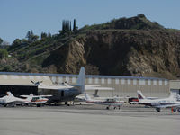
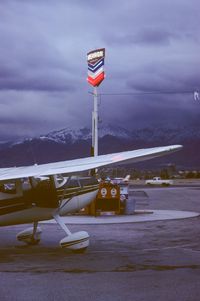
Whiteman Airport (WHP/KWHP) is a public-use airport located in Los Angeles, CA. The airport sits at an elevation of 1003 feet above mean sea level. It features 1 runway. Aviation communications are supported by 14 published radio frequencies. The gallery includes 4 photos of operations and aircraft at the airport.
| FAA Information Effective | 2026-09-03 |
| Airport Identifier | WHP |
| Airport Status | Operational |
| Longitude/Latitude |
118°24'48.3590"
W /
34°15'33.5710"
N -118.413433 / 34.259325 (Estimated) |
| Elevation | 1003.00 ft / 305.71 m (Estimated) |
| Land | 184 acres |
| From nearest city | 1 nautical miles E of Los Angeles, CA |
| Location | Los Angeles County, CA |
| Magnetic Variation | 14E (1990) |
| Airport Use | Open to public |
| Wind indicator | Yes |
| Segmented Circle | Yes |
| Control Tower | ATCT |
| Lighting Schedule | SEE RMK |
| Beacon Color | White-Green (lighted land airport) |
| Sectional chart | LOS ANGELES |
| Region | AWP - Western-Pacific |
| Responsible ARTCC | ZLA - LOS ANGELES |
| Tie-in FSS | HHR - HAWTHORNE |
| FSS on Airport | No |
| FSS Toll Free | 1-800-WX-BRIEF |
| NOTAMs Facility | WHP (NOTAM-d service available) |
Runway 12/30
| Dimensions | 4120 x 75 ft (1256 x 23 m) |
| Surface | ASPH (GOOD) |
| Surface treatment | |
| Edge lights | Medium |
| 12 | 30 | |
|---|---|---|
| Alignment | 139° | 319° |
| Physical elevation | 1003.00 ft | 960.00 ft |
| Coordinates | 34.263528 / -118.417925 | 34.255017 / -118.408931 |
| Traffic pattern | Left | Right |
| Runway marking | Basic , Good Condition | Basic , Good Condition |
| VGSI |
2-light PAPI on right *PAPI DOES NOT PRVD OBSTN CLNC BYD 5 NM FROM THLD. |
2-light PAPI on left |
| Runway end lights | Yes | Yes |
| CL lights | No | No |
| TDZ lights | No | No |
- HELICOPTER OPNS 2500' MSL (1500' AGL) AND BELOW.
- FOR CD WHEN ATCT CLSD CTC SOCAL APCH AT 800-448-3724.
- VOLUNTARY CURFEW IN EFCT. ALL ACFT OPRS, EXCP FOR FLTS RELATED TO EMERG, LIFESAVING, FIREFIGHTING, LAW ENFORCEMENT, GOVT AGENCIES, AND SVCS TO THE PUBLIC SUCH AS NEWS MEDIA, ARE REQD TO AVOID CONDUCTING ACFT ARRS AND DEPS BTN 2200 AND 0600 DAILY.
- POWER LINES SW OF RY PENETRATE 7:1 TRANSITIONAL SFC.
- BIRDS ON AND INVOF ARPT.
- (E125) INCLUDES 3 AMPHIBIANS.
- AIRPORT CLOSED TO HELICOPTER TRAINING / PATTERN OPERATIONS 2000-0800.
- DIRT INFIELD AREAS. HELICOPTERS ADVISED TO USE CARE TO PREVENT BLASTING DIRT AND DEBRIS ONTO MOVEMENT AREAS.