Home | Forums | Photographers | Articles | Airport Finder | Member Section | Support Center

Frederick Municipal Airport (FDK) Photo

Frederick Municipal Airport (FDK) Profile    Home


Photo ID: AP1064

Low fares flights worldwide

Frederick Municipal Airport (FDK) - One of the

Photo Info

Airport Frederick Municipal Airport (FDK)
Frederick, MD
Photographer: Sam Andrews
More photos by Sam Andrews
Contact Sam Andrews
Shot Date: 2006-06-03

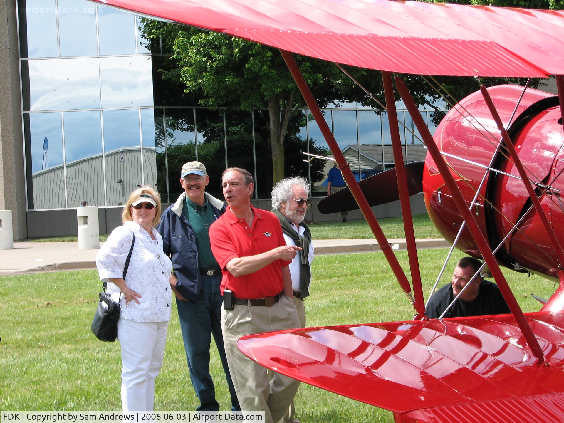
One of the "icons" of the airport. Phil Boyer; Pres. AOPA (red shirt) checking out one of the former AOPA sweepstakes planes that flew in for the 2006 AOPA Fly-In.

Photo MetaData

Device Manufacturer: Canon
Device Model: Canon PowerShot S2 IS
Device Type: Digital Still Camera
Shot Time: 2006:06:03 14:56:24
Original Image Size: 2592 x 1944 pixels
Exposure Time: 1/320 sec
F Number: f 4
Exposure Bias: 0
ISO Speed:
Focal Length: 18.6 mm
Flash: No Flash
Exposure Mode: 0
White Balance: 0
Scene Type:
Contrast:
Saturation:
Sharpness:


Total 14 photos. View all photos
More photos of Frederick Municipal Airport (FDK)
Frederick Municipal Airport (FDK) - The trnscient flight line on AOPA Fly-in day 2006 - by Sam Andrews
by Sam Andrews
Frederick Municipal Airport (FDK) - IF the weather had been better the morning of the 2006 AOPA Fly-In I'm certain there would have been more airplanes.  There were more to my left and behind but there would have been more - by Sam Andrews
by Sam Andrews
Frederick Municipal Airport (FDK) - One of the icons of the airport. Phil Boyer; Pres. AOPA (red shirt) checking out one of the former AOPA sweepstakes planes that flew in for the 2006 AOPA Fly-In. - by Sam Andrews
by Sam Andrews
Frederick Municipal Airport (FDK) - the flight/static display area - by Sam Andrews
by Sam Andrews


Home |  Member Section |  Forums |  Privacy Policy |  Disclaimer |  About Us |  Contact Us |  Past Logos |  Aviation Search

Copyright 2004-2008, Airport-Data.com. All rights reserved.
Airport-Data.com does not guarantee the accuracy or timeliness of any information on this site. Use at your own risk.
Do NOT use these information for navigation, flight planning, or for use in flight.